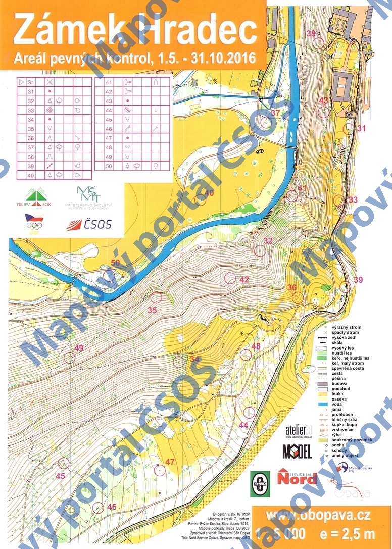
Map Zámek Hradec
Basic map data
| Scale | 1:5000 | Equidistance | 2.5m | Sport | Foot-O/print | Specification | ISSprOM (sprint foot-O) |
|---|---|---|---|---|---|---|---|
| Year | 2016 | Published by | Orientační Běh Opava | Filing number | 16T013P | ||
| Blocking until | 2025 | Blocking reason | |||||
| Map admin | Orientační Běh Opava | Publisher | AOP - Orientační Běh Opava | Educational map | ano | ||
| Locality | Hradec nad Moravicí | Kraj | Moravskoslezský kraj | Area size | 0.913 km2 | ||
| Based on | mapa OB | Stav | 2016-04 | Drawing technique | OCAD 9 | ||
| Printed in | NordService | Print technique | laser | ||||
| Note (public) | OBJEV ŠOK, areál pevných kontrol. Existuje dotisk s modrým podložením textů místo oranžového. | ||||||
| Entry created by | Miroslav Hadač | Archive | bbb0 | ID/status | 8534 / archived | ||
Autoři
| Name | Role |
|---|---|
| Lenhart Zdeněk | mapped, drew |
| Kostka Evžen | revised |
Obrys mapy
Map preview
Using the map without publisher's permission for organized events is copyright piracy. Please contact the map administrator listed in the Map Archive database and obtain maps in full quality for printing.
Našli jste problém v záznamu (nesprávné nebo chybějící údaje, špatný obrys)? Budeme rádi, pokud nám o tom řeknete.