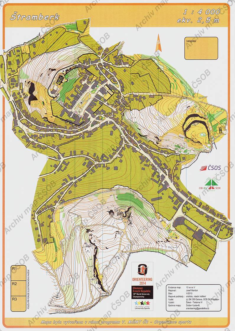
Map Štramberk
Basic map data
| Scale | 1:4000 | Equidistance | 2.5m | Sport | Foot-O/print | Specification | ISSprOM (sprint foot-O) |
|---|---|---|---|---|---|---|---|
| Year | 2013 | Published by | SK OB Ostrava, SK Prostějov | Filing number | 13xxxxV | ||
| Blocking until | 2022 | Blocking reason | |||||
| Map admin | Dušan Vystavěl, orienteering@geodetika.cz | Publisher | MOV - SKOB Ostrava | Educational map | ano | ||
| Locality | Štramberk | Kraj | Moravskoslezský kraj | Area size | 0.621 km2 | ||
| Based on | ortofoto, vlastní měření | Stav | 2013-05 | Drawing technique | OCAD | ||
| Printed in | OOS SK Prostějov | Print technique | 5 colors | ||||
| Note (public) | OBJEV ŠOK, s rámečkem. | ||||||
| Entry created by | archiv ČSOS | Archive | aaa1 | ID/status | 7218 / archived | ||
Autoři
| Name | Role |
|---|---|
| Marduk Josef | mapped |
Obrys mapy
Map preview
Using the map without publisher's permission for organized events is copyright piracy. Please contact the map administrator listed in the Map Archive database and obtain maps in full quality for printing.
Našli jste problém v záznamu (nesprávné nebo chybějící údaje, špatný obrys)? Budeme rádi, pokud nám o tom řeknete.