Map Decathlon - outdoor
Basic map data
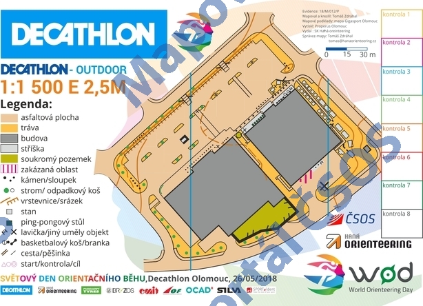
| Scale | 1:1500 | Equidistance | 2.5m | Sport | Foot-O/print | Specification | ISSprOM (sprint foot-O) |
|---|---|---|---|---|---|---|---|
| Year | 2018 | Published by | SK Haná orienteering | Filing number | 18M012P | ||
| Blocking until | 0 | Blocking reason | |||||
| Map admin | Tomáš Zdráhal | Publisher | OOL - SK Haná orienteering | Educational map | ano | ||
| Locality | Olomouc - Horní lán | Kraj | Olomoucký kraj | Area size | 0.024 km2 | ||
| Based on | Mapa Giga sport, ortofoto | Stav | 2018-05 | Drawing technique | OCAD | ||
| Printed in | Properus Olomouc | Print technique | CMYK | ||||
| Note (public) | OBJEV ŠOK. | ||||||
| Main race (title) | WOD Decathlon | Main race (date) | 26. 05. 2018 | ||||
| Entry created by | Tomáš Zdráhal | Archive | Do Archivu nebyly dodány papírové výtisky. | ID/status | 9797 / not filed | ||
Autoři
| Name | Role |
|---|---|
| Zdráhal Tomáš jun. | mapped |
| --- | drew |
Obrys mapy
Map preview
Using the map without publisher's permission for organized events is copyright piracy. Please contact the map administrator listed in the Map Archive database and obtain maps in full quality for printing.
Našli jste problém v záznamu (nesprávné nebo chybějící údaje, špatný obrys)? Budeme rádi, pokud nám o tom řeknete.