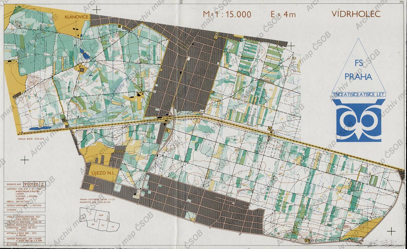
Map Vídrholec
Basic map data
| Scale | 1:15000 | Equidistance | 4.0m | Sport | Foot-O | Specification | ISOM (foot-O) |
|---|---|---|---|---|---|---|---|
| Year | 1991 | Published by | VŠTJ FS Praha | Filing number | 910105Z | ||
| Blocking until | 2000 | Blocking reason | |||||
| Map admin | - | Publisher | FSP - VSK ČVUT Fakulta Stavební Praha | Educational map | ne | ||
| Locality | Klánovice (Praha 17v) | Area size | 18.0 km2 | ||||
| Based on | ZM10+OB | Stav | Drawing technique | ink, pen | |||
| Printed in | VŠTJ FS Praha | Print technique | 5 colors | ||||
| Main race (title) | Praž.žebř.) | Main race (date) | 12. 10. 1991 | ||||
| Entry created by | archiv ČSOS | Archive | aaa3 | ID/status | 403 / archived | ||
Autoři
| Name | Role |
|---|---|
| Netuka Jan | drew, mapped, main cartographer |
| Tojnar Jan | mapped |
| Novák Ivo | mapped |
| Utinek Petr | mapped |
| Westfalová Marie | mapped |
| Rajfová Blanka | mapped |
Obrys mapy
Map preview
Using the map without publisher's permission for organized events is copyright piracy. Please contact the map administrator listed in the Map Archive database and obtain maps in full quality for printing.
Našli jste problém v záznamu (nesprávné nebo chybějící údaje, špatný obrys)? Budeme rádi, pokud nám o tom řeknete.