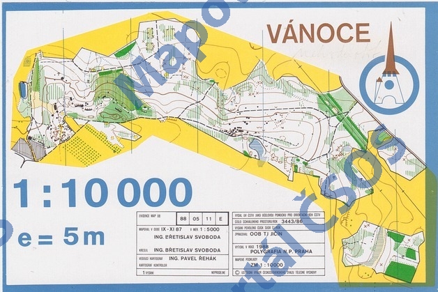
Map Vánoce
Basic map data
| Scale | 1:10000 | Equidistance | 5.0m | Sport | Foot-O | Specification | ISOM (foot-O) |
|---|---|---|---|---|---|---|---|
| Year | 1988 | Published by | TJ Jičín | Filing number | 880511E | ||
| Blocking until | 1997 | Blocking reason | |||||
| Map admin | - | Publisher | TJC | Educational map | ne | ||
| Locality | Drštěkryje (Jičín 7zsz) | Kraj | Královéhradecký kraj | Area size | 0.896 km2 | ||
| Based on | ZM10 | Stav | 1987-11 | Drawing technique | ink, pen | ||
| Printed in | Polygrafia Praha | Print technique | 5 colors | ||||
| Entry created by | archiv ČSOS | Archive | aaa2 | ID/status | 1238 / archived | ||
Autoři
| Name | Role |
|---|---|
| Svoboda Břetislav | drew, mapped |
| Řehák Pavel | main cartographer |
Obrys mapy
Map preview
Using the map without publisher's permission for organized events is copyright piracy. Please contact the map administrator listed in the Map Archive database and obtain maps in full quality for printing.
Našli jste problém v záznamu (nesprávné nebo chybějící údaje, špatný obrys)? Budeme rádi, pokud nám o tom řeknete.