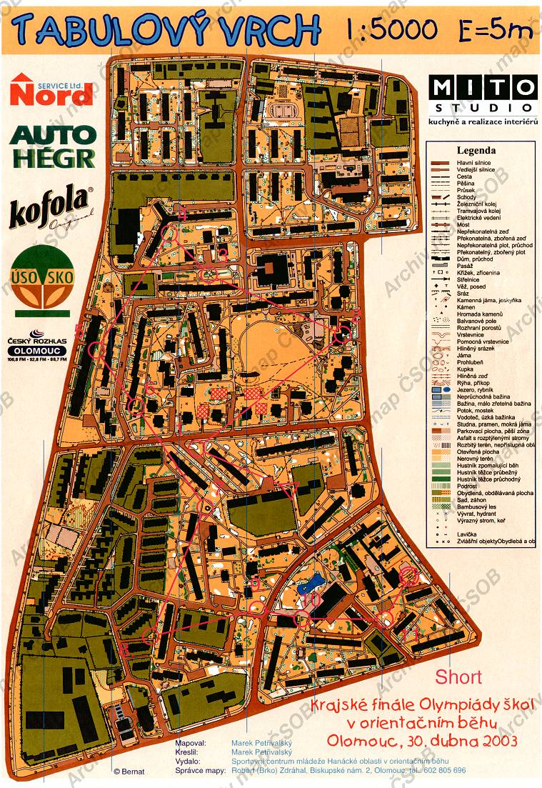
Map Tabulový vrch
Map basic data
| Scale | 1:5000 | Equidistance | 0.0m | Sport | Foot-O/print | Specification | ISSprOM (sprint foot-O) |
|---|---|---|---|---|---|---|---|
| Year | 2008 | Published by | SCM Hanácké oblasti | Filing number | - | ||
| Blocking until | 0 | Blocking reason | |||||
| Map admin | Robert Brko Zdráhal, Biskupské nám.2, Olomouc, 602 805 696 | Publisher | OOL - SK Haná orienteering | Educational map | ne | ||
| Locality | Olomouc - Neředín | Kraj | Olomoucký kraj | Area size | 0.784 km2 | ||
| Based on | - | Stav | - | Drawing technique | OCAD | ||
| Printed in | - | Print technique | laser | ||||
| Main race (title) | Olympiáda škol, krajské finále, KT | Main race (date) | 30. 04. 2003 | ||||
| Entry created by | archiv ČSOS | Archive | bbb0 | ID/status | 6437 / archived | ||
Autoři
| Name | Role |
|---|---|
| Petřivalský Marek | mapped, drew |
Obrys mapy
Map preview
Using the map without publisher's permission for organized events is copyright piracy. Please contact the map administrator listed in the Map Archive database and obtain maps in full quality for printing.
Našli jste problém v záznamu (nesprávné nebo chybějící údaje, špatný obrys)? Budeme rádi, pokud nám o tom řeknete.