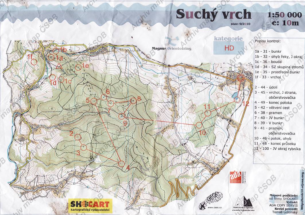
Map Suchý vrch
Basic map data
| Scale | 1:50000 | Equidistance | 10.0m | Sport | Extreme | Specification | Topographic map |
|---|---|---|---|---|---|---|---|
| Year | 2010 | Published by | Magnus Orienteering | Filing number | - | ||
| Blocking until | 0 | Blocking reason | |||||
| Map admin | hrob10.aljosa.org | Publisher | ASU - Magnus Orienteering | Educational map | ne | ||
| Locality | Jablonné nad Orlicí, Králíky | Area size | 105.47 km2 | ||||
| Based on | Shocart | Stav | Drawing technique | OCAD 7 | |||
| Printed in | ADA COPY SERVIS | Print technique | laser | ||||
| Note (public) | Jen JPG z webu. | ||||||
| Entry created by | archiv ČSOS | Archive | c000 | ID/status | 6733 / archived | ||
Autoři
| Name | Role |
|---|---|
| Leštínský Tomáš | revised |
Obrys mapy
Map preview
Using the map without publisher's permission for organized events is copyright piracy. Please contact the map administrator listed in the Map Archive database and obtain maps in full quality for printing.
Našli jste problém v záznamu (nesprávné nebo chybějící údaje, špatný obrys)? Budeme rádi, pokud nám o tom řeknete.