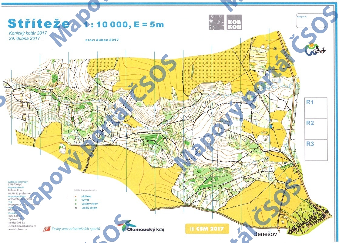
Map Stříteže
Basic map data
| Scale | 1:10000 | Equidistance | 5.0m | Sport | Foot-O | Specification | ISOM (foot-O) |
|---|---|---|---|---|---|---|---|
| Year | 2017 | Published by | Klub orinetačního běhu Konice | Filing number | 17B004O | ||
| Blocking until | 2026 | Blocking reason | |||||
| Map admin | KOB Konice, Tyršova 397, 798 52 Konice | Publisher | KON - KOB Konice | Educational map | ne | ||
| Locality | Benešov (Boskovice 8vsv) | Kraj | Jihomoravský kraj | Area size | 3.029 km2 | ||
| Based on | ortofoto, DMR 4G | Stav | 2017-04 | Drawing technique | OCAD 11 | ||
| Printed in | Properus, s. r. o. Olomouc | Print technique | laser | ||||
| Main race (title) | Oblastní žebříček | Main race (date) | 2017-04-29 | ||||
| Entry created by | Miroslav Hlava | Archive | aaa0 | ID/status | 9090 / archived | ||
Autoři
| Name | Role |
|---|---|
| Háj Bohumil 1956 | mapped, drew |
Obrys mapy
Map preview
Using the map without publisher's permission for organized events is copyright piracy. Please contact the map administrator listed in the Map Archive database and obtain maps in full quality for printing.
Našli jste problém v záznamu (nesprávné nebo chybějící údaje, špatný obrys)? Budeme rádi, pokud nám o tom řeknete.