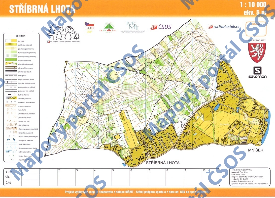
Map Stříbrná Lhota
Basic map data
| Scale | 1:10000 | Equidistance | 5.0m | Sport | Foot-O | Specification | ISOM (foot-O) |
|---|---|---|---|---|---|---|---|
| Year | 2017 | Published by | OK Dobříš | Filing number | 17S003O | ||
| Blocking until | 2026 | Blocking reason | |||||
| Map admin | Jindřich Houska | Publisher | DOR - OK Dobříš | Educational map | ano | ||
| Locality | Mníšek pod Brdy | Kraj | Středočeský kraj | Area size | 2.234 km2 | ||
| Based on | ortofoto, laserscan | Stav | 2017-02 | Drawing technique | OCAD 11 | ||
| Printed in | Žaket - Tiskárna IV | Print technique | CMYK | ||||
| Note (public) | OBJEV ŠOK. | ||||||
| Entry created by | Kamil Arnošt | Archive | aaa1 | ID/status | 8968 / archived | ||
Autoři
| Name | Role |
|---|---|
| Uher Petr | mapped |
Obrys mapy
Map preview
Using the map without publisher's permission for organized events is copyright piracy. Please contact the map administrator listed in the Map Archive database and obtain maps in full quality for printing.
Našli jste problém v záznamu (nesprávné nebo chybějící údaje, špatný obrys)? Budeme rádi, pokud nám o tom řeknete.