Mapa byla schválena.
Basic map data
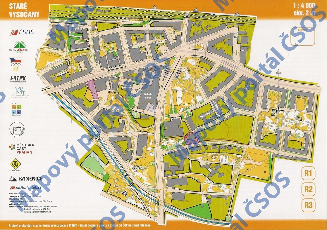
| Scale |
1:4000 |
Equidistance |
2.0m |
Sport |
Foot-O/print
|
Specification |
ISSprOM (sprint foot-O)
|
| Year |
2017
|
Published by |
©OK Kamenice |
Filing number |
17A017P |
| Blocking until |
2026 |
Blocking reason |
|
| Map admin |
Přemysl Prášek, Na rozcestí 1296/12 Praha 9 - Vysočany 190 00
|
Publisher |
KAM - OK Kamenice
|
Educational map |
ano |
| Locality |
Praha 9, Vysočany |
Kraj |
Praha |
Area size |
0.555 km2
|
| Based on |
UMPS, Laserscan |
Stav |
září 2017 |
Drawing technique |
OCAD 10
|
| Printed in |
©Kartum |
Print technique |
CMYK/laser
|
| Note (public) |
OBJEV ŠOK, grafika výukové mapy |
| Entry created by |
Přemysl Prášek |
|
ID/status |
9281 / approved and closed |
Autoři
Obrys mapy
Map preview
Using the map without publisher's permission for organized events is copyright piracy. Please contact the map administrator listed in the Map Archive database and obtain maps in full quality for printing.