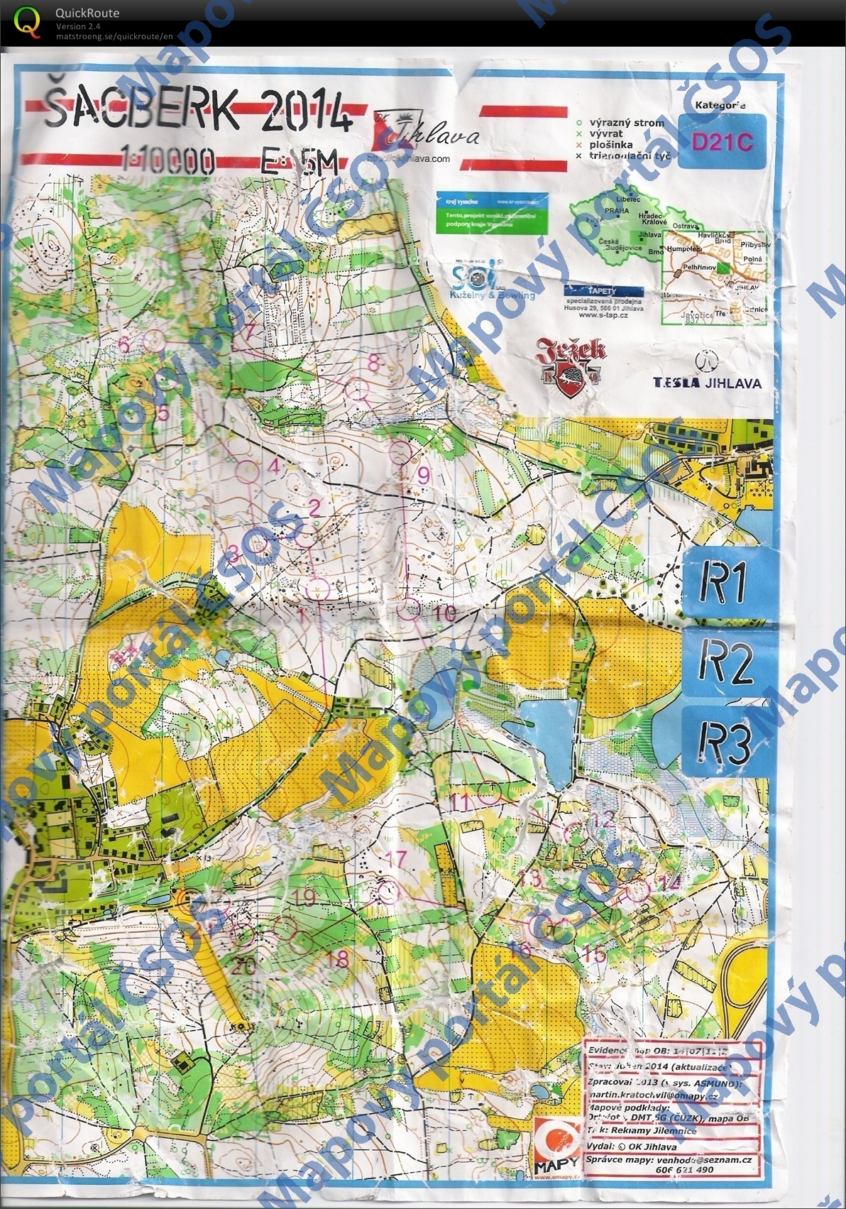
Map Šacberk 2014
Basic map data
| Scale | 1:10000 | Equidistance | 5.0m | Sport | Foot-O | Specification | ISOM (foot-O) |
|---|---|---|---|---|---|---|---|
| Year | 2014 | Published by | OK Jihlava | Filing number | 140712Z | ||
| Blocking until | 2023 | Blocking reason | |||||
| Map admin | venhoda@seznam.cz | Publisher | SJI - OK Jihlava | Educational map | ne | ||
| Locality | Zborná (Jihlava 5s) | Kraj | Kraj Vysočina | Area size | 4.29 km2 | ||
| Based on | ortofoto, DMR 5G, OB | Stav | 2014-04 | Drawing technique | vector editor | ||
| Printed in | Reklamy Jilemnice | Print technique | laser | ||||
| Note (public) | Jen JPG. Zpracováno v systému ASMUND. | ||||||
| Entry created by | Zdeněk Lenhart | Archive | c--0 | ID/status | 7566 / archived | ||
Autoři
| Name | Role |
|---|---|
| Kratochvíl Martin | prepared |
Obrys mapy
Map preview
Using the map without publisher's permission for organized events is copyright piracy. Please contact the map administrator listed in the Map Archive database and obtain maps in full quality for printing.
Našli jste problém v záznamu (nesprávné nebo chybějící údaje, špatný obrys)? Budeme rádi, pokud nám o tom řeknete.