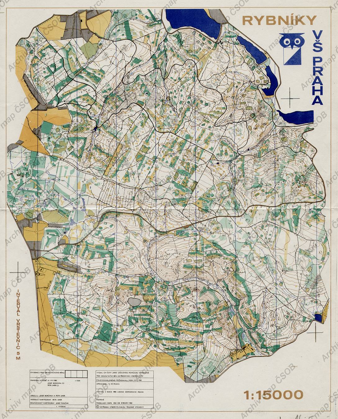
Map Rybníky
Basic map data
| Scale | 1:15000 | Equidistance | 5.0m | Sport | Foot-O | Specification | ISOM (foot-O) |
|---|---|---|---|---|---|---|---|
| Year | 1985 | Published by | VŠ Praha | Filing number | - | ||
| Blocking until | 0 | Blocking reason | |||||
| Map admin | - | Publisher | VSP - USK Praha | Educational map | ne | ||
| Locality | Jevany (Kostelec n.Č.L. 4jz) | Area size | 23.5 km2 | ||||
| Based on | OB | Stav | Drawing technique | ink, pen | |||
| Printed in | Lidová Demokracie Praha | Print technique | 5 colors | ||||
| Note (public) | v tiráži Vytiskla Lidová demokracie... | ||||||
| Main race (title) | M ČSSR DT) | Main race (date) | 05. 10. 1985 | ||||
| Entry created by | archiv ČSOS | Archive | abb2 | ID/status | 132 / archived | ||
Autoři
| Name | Role |
|---|---|
| Rančák Josef | delegated cartographer |
| Borůvka Josef | drew, mapped |
| Uher Petr | drew, mapped, main cartographer |
Obrys mapy
Map preview
Using the map without publisher's permission for organized events is copyright piracy. Please contact the map administrator listed in the Map Archive database and obtain maps in full quality for printing.
Našli jste problém v záznamu (nesprávné nebo chybějící údaje, špatný obrys)? Budeme rádi, pokud nám o tom řeknete.