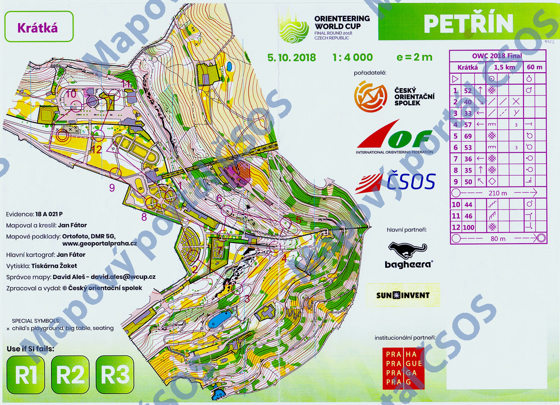
Map Petřín
Basic map data
| Scale | 1:4000 | Equidistance | 2.0m | Sport | Foot-O/print | Specification | ISSprOM (sprint foot-O) |
|---|---|---|---|---|---|---|---|
| Year | 2018 | Published by | Český orientační spolek | Filing number | 18A021P | ||
| Blocking until | 2027 | Blocking reason | |||||
| Map admin | David Aleš | Publisher | TJN - OOB TJ Tatran Jablonec n. N. | Educational map | ne | ||
| Locality | Praha - Petřín | Kraj | Praha | Area size | 0.326 km2 | ||
| Based on | ortofoto, DMR5G, www.geoportalpraha.cz | Stav | 2018-09 | Drawing technique | OCAD 11 | ||
| Printed in | Žaket | Print technique | CMYK/laser | ||||
| Main race (title) | Sprintové štafety SP | Main race (date) | 05. 10. 2018 | ||||
| Entry created by | Jan Picek | Archive | bb-0 | ID/status | 9952 / archived | ||
Autoři
| Name | Role |
|---|---|
| Fátor Jan | mapped, drew, main cartographer |
Obrys mapy
Map preview
Using the map without publisher's permission for organized events is copyright piracy. Please contact the map administrator listed in the Map Archive database and obtain maps in full quality for printing.
Našli jste problém v záznamu (nesprávné nebo chybějící údaje, špatný obrys)? Budeme rádi, pokud nám o tom řeknete.