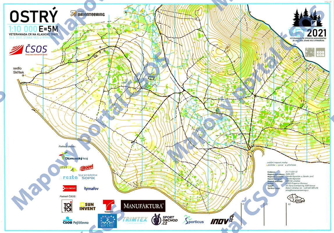
Map Ostrý
Basic map data
| Scale | 1:10000 | Equidistance | 5.0m | Sport | Foot-O | Specification | ISOM (foot-O) |
|---|---|---|---|---|---|---|---|
| Year | 2021 | Published by | SK Haná orienteering | Filing number | 21T022O | ||
| Blocking until | 2030 | Blocking reason | |||||
| Map admin | Robert Zdráhal | Publisher | OOL - SK Haná orienteering | Educational map | ne | ||
| Locality | Ždárský Potok (Rýmařov 6sz) | Kraj | Moravskoslezský kraj | Area size | 3.712 km2 | ||
| Based on | DMR 5G, ortofoto | Stav | 2021-06 | Drawing technique | OCAD 2018 | ||
| Printed in | Properus Olomouc | Print technique | other | ||||
| Main race (title) | Veteraniáda ČR na klasické trati | Main race (date) | 2021-06-26 | ||||
| Entry created by | Tomáš Zdráhal | Archive | aaa0 | ID/status | 11627 / archived | ||
Autoři
| Name | Role |
|---|---|
| Rajnošek Zdeněk 1985 | main cartographer, mapped, drew |
| Janů Zdeněk ml. | mapped, drew |
Obrys mapy
Map preview
Using the map without publisher's permission for organized events is copyright piracy. Please contact the map administrator listed in the Map Archive database and obtain maps in full quality for printing.
Našli jste problém v záznamu (nesprávné nebo chybějící údaje, špatný obrys)? Budeme rádi, pokud nám o tom řeknete.