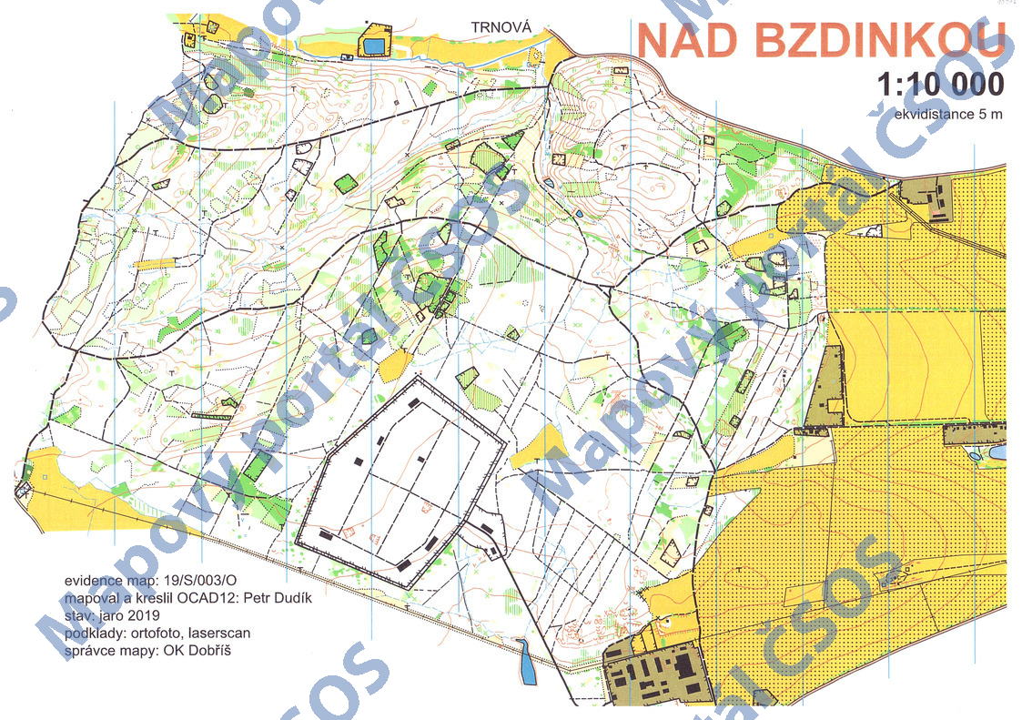
Map Nad Bzdinkou
Basic map data
| Scale | 1:10000 | Equidistance | 5.0m | Sport | Foot-O | Specification | ISOM (foot-O) |
|---|---|---|---|---|---|---|---|
| Year | 2019 | Published by | OK Dobříš | Filing number | 19S003O | ||
| Blocking until | 2028 | Blocking reason | |||||
| Map admin | OK Dobříš | Publisher | DOR - OK Dobříš | Educational map | ne | ||
| Locality | Dobříš | Kraj | Středočeský kraj | Area size | 4.327 km2 | ||
| Based on | ortofoto, laserscan | Stav | 2019 jaro | Drawing technique | OCAD 12 | ||
| Printed in | - | Print technique | laser | ||||
| Entry created by | Kamil Arnošt | Archive | aaa0 | ID/status | 10076 / archived | ||
Autoři
| Name | Role |
|---|---|
| Dudík Petr 1955 | mapped, drew |
Obrys mapy
Map preview
Using the map without publisher's permission for organized events is copyright piracy. Please contact the map administrator listed in the Map Archive database and obtain maps in full quality for printing.
Našli jste problém v záznamu (nesprávné nebo chybějící údaje, špatný obrys)? Budeme rádi, pokud nám o tom řeknete.