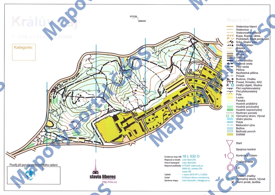
Map Králův háj
Basic map data
| Scale | 1:5000 | Equidistance | 2.5m | Sport | Foot-O | Specification | ISOM (foot-O) |
|---|---|---|---|---|---|---|---|
| Year | 2016 | Published by | Slavia Liberec orienteering | Filing number | 16L032O | ||
| Blocking until | 2025 | Blocking reason | |||||
| Map admin | Libor Bednařík, Aloisina výšina 632/108, 46015 Liberec 15 | Publisher | VLI - Slavia Liberec orienteering | Educational map | ne | ||
| Locality | Liberec - Králův háj | Kraj | Liberecký kraj | Area size | 0.357 km2 | ||
| Based on | DMR5G, ortofoto, OB | Stav | 2016-08 | Drawing technique | OCAD 11 | ||
| Printed in | HP LJ C2025 | Print technique | laser | ||||
| Main race (title) | Podzimní kufrování 2016 | Main race (date) | 20. 09. 2016 | ||||
| Entry created by | Libor Bednarik | Archive | aaa0 | ID/status | 8777 / archived | ||
Autoři
| Name | Role |
|---|---|
| Bednařík Libor | mapped, drew, main cartographer |
Obrys mapy
Map preview
Using the map without publisher's permission for organized events is copyright piracy. Please contact the map administrator listed in the Map Archive database and obtain maps in full quality for printing.
Našli jste problém v záznamu (nesprávné nebo chybějící údaje, špatný obrys)? Budeme rádi, pokud nám o tom řeknete.