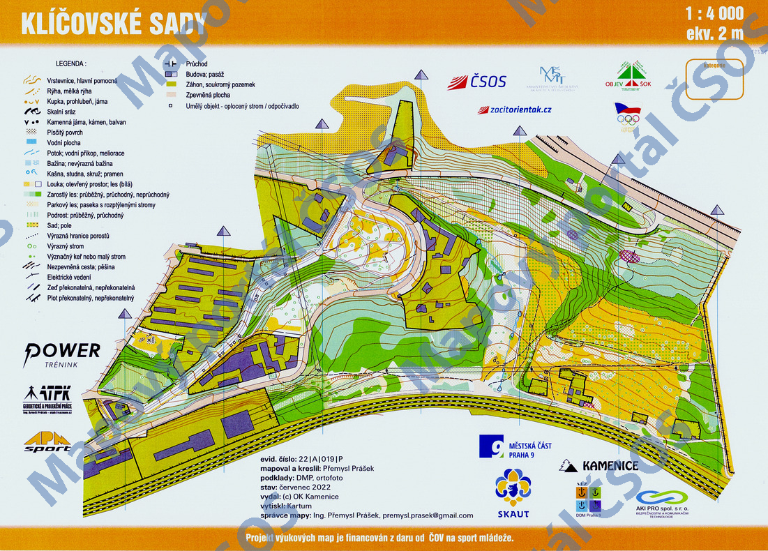
Map Klíčovské sady
Basic map data
| Scale | 1:4000 | Equidistance | 2.0m | Sport | Foot-O/print | Specification | ISSprOM (sprint foot-O) |
|---|---|---|---|---|---|---|---|
| Year | 2022 | Published by | © OK Kamenice | Filing number | 22A019P | ||
| Blocking until | 2031 | Blocking reason | |||||
| Map admin | Ing. Přemysl Prášek | Publisher | KAM - OK Kamenice | Educational map | ano | ||
| Locality | Praha 9 - Klíčov | Kraj | Praha | Area size | 0.391 km2 | ||
| Based on | Ortofoto, DMP | Stav | 2022-07 | Drawing technique | OCAD 10 | ||
| Printed in | Kartum | Print technique | CMYK/laser | ||||
| Note (public) | OBJEV ŠOK. | ||||||
| Main race (title) | Příměstský tábor DDM - Skaut | Main race (date) | 26. 08. 2022 | ||||
| Entry created by | Přemysl Prášek | Archive | aaa0 | ID/status | 12321 / archived | ||
Autoři
| Name | Role |
|---|---|
| Prášek Přemysl | mapped, drew, prepared |
| Matějů Luboš | graphic designer |
Obrys mapy
Map preview
Using the map without publisher's permission for organized events is copyright piracy. Please contact the map administrator listed in the Map Archive database and obtain maps in full quality for printing.
Našli jste problém v záznamu (nesprávné nebo chybějící údaje, špatný obrys)? Budeme rádi, pokud nám o tom řeknete.