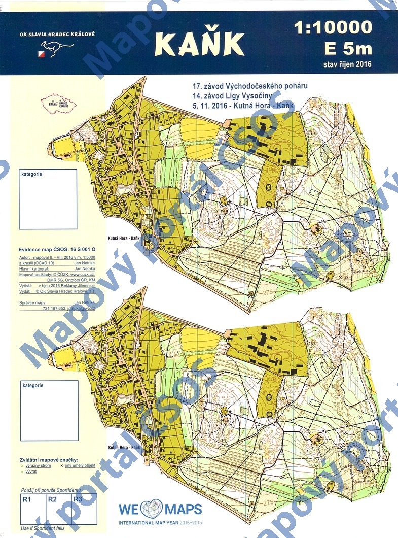
Map Kaňk
Basic map data
| Scale | 1:10000 | Equidistance | 5.0m | Sport | Foot-O | Specification | ISOM (foot-O) |
|---|---|---|---|---|---|---|---|
| Year | 2016 | Published by | OK Slavia Hradec Králové, z.s. | Filing number | 16S001O | ||
| Blocking until | 2025 | Blocking reason | |||||
| Map admin | Jan Netuka | Publisher | SHK - OK Slavia Hradec Králové | Educational map | ne | ||
| Locality | Kutná Hora | Kraj | Středočeský kraj | Area size | 1.342 km2 | ||
| Based on | DMR 5G, Ortofoto ČR, KM | Stav | 2016-10 | Drawing technique | OCAD 10 | ||
| Printed in | Reklamy Jilemnice | Print technique | laser | ||||
| Note (public) | na listu A4 dvakrát shodná kresba téhož prostoru. | ||||||
| Main race (title) | Oblastní žebříček | Main race (date) | 2016-11-05 | ||||
| Entry created by | Jan Netuka | Archive | aaa0 | ID/status | 8114 / archived | ||
Autoři
| Name | Role |
|---|---|
| Netuka Jan | mapped, drew, main cartographer |
Obrys mapy
Map preview
Using the map without publisher's permission for organized events is copyright piracy. Please contact the map administrator listed in the Map Archive database and obtain maps in full quality for printing.
Našli jste problém v záznamu (nesprávné nebo chybějící údaje, špatný obrys)? Budeme rádi, pokud nám o tom řeknete.