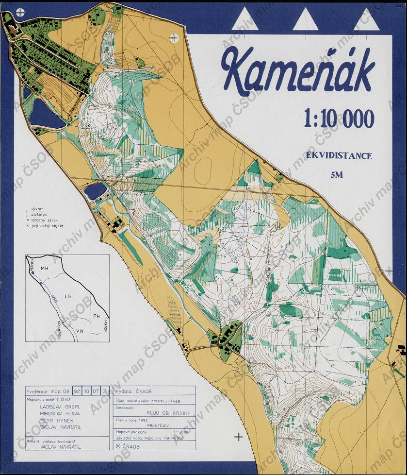
Map Kameňák
Basic map data
| Scale | 1:10000 | Equidistance | 5.0m | Sport | Foot-O | Specification | ISOM (foot-O) |
|---|---|---|---|---|---|---|---|
| Year | 1992 | Published by | Klub OB Konice | Filing number | 921007Z | ||
| Blocking until | 2001 | Blocking reason | |||||
| Map admin | - | Publisher | KON - KOB Konice | Educational map | ne | ||
| Locality | Konice | Area size | 4.29 km2 | ||||
| Based on | OB | Stav | Drawing technique | ink, pen | |||
| Printed in | Prostějov | Print technique | 5 colors | ||||
| Entry created by | archiv ČSOS | Archive | aaa1 | ID/status | 2542 / archived | ||
Autoři
| Name | Role |
|---|---|
| Navrátil Václav | drew, mapped, main cartographer |
| Hynek Petr | mapped |
| Hlava Miroslav | mapped |
| Grepl Ladislav | mapped |
Obrys mapy
Map preview
Using the map without publisher's permission for organized events is copyright piracy. Please contact the map administrator listed in the Map Archive database and obtain maps in full quality for printing.
Našli jste problém v záznamu (nesprávné nebo chybějící údaje, špatný obrys)? Budeme rádi, pokud nám o tom řeknete.