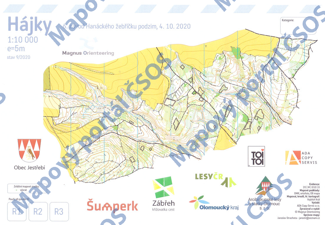
Map Hájky
Basic map data
| Scale | 1:10000 | Equidistance | 5.0m | Sport | Foot-O | Specification | ISOM (foot-O) |
|---|---|---|---|---|---|---|---|
| Year | 2020 | Published by | Magnus Orienteering z.s. | Filing number | 20M010O | ||
| Blocking until | 2029 | Blocking reason | |||||
| Map admin | Jaroslav Strachota | Publisher | ASU - Magnus Orienteering | Educational map | ne | ||
| Locality | Pobučí (Zábřeh 5jjz) | Kraj | Olomoucký kraj | Area size | 2.303 km2 | ||
| Based on | DMR, ortofoto, OB mapa | Stav | 2020-09 | Drawing technique | OO-mapper | ||
| Printed in | ADA Copy servis s.r.o. | Print technique | laser | ||||
| Main race (title) | Oblastní žebříček | Main race (date) | 2020-10-03 | ||||
| Entry created by | Martin Štoudek | Archive | aaa0 | ID/status | 11204 / archived | ||
Autoři
| Name | Role |
|---|---|
| Král Vojtěch SSU | mapped, drew, main cartographer |
Obrys mapy
Map preview
Using the map without publisher's permission for organized events is copyright piracy. Please contact the map administrator listed in the Map Archive database and obtain maps in full quality for printing.
Našli jste problém v záznamu (nesprávné nebo chybějící údaje, špatný obrys)? Budeme rádi, pokud nám o tom řeknete.