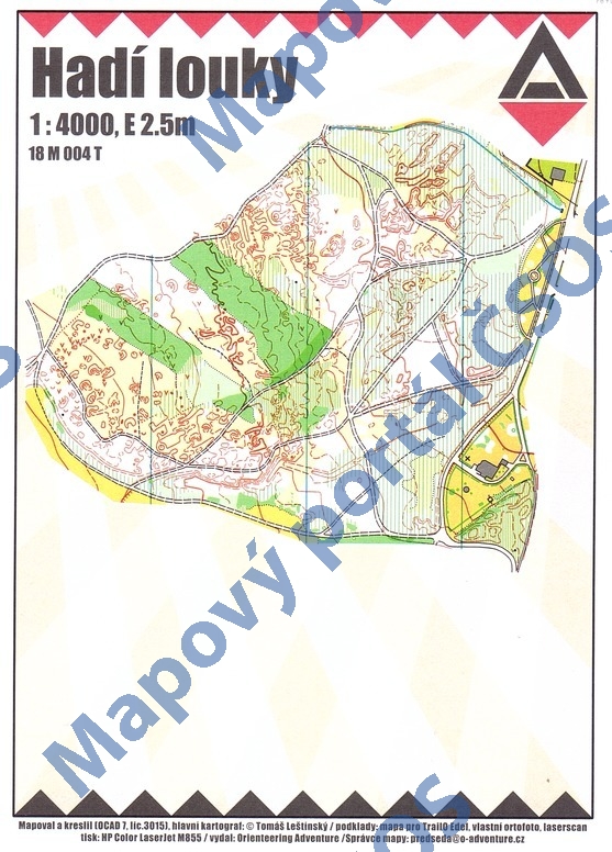
Map Hadí louky
Basic map data
| Scale | 1:4000 | Equidistance | 2.5m | Sport | Trail-O | Specification | ISSprOM (sprint foot-O) |
|---|---|---|---|---|---|---|---|
| Year | 2018 | Published by | Orienteering Adventure | Filing number | 18M004T | ||
| Blocking until | 2027 | Blocking reason | |||||
| Map admin | Tomáš Leštínský | Publisher | OAV - Orienteering Adventure | Educational map | ne | ||
| Locality | Zlaté Hory | Kraj | Olomoucký kraj | Area size | 0.164 km2 | ||
| Based on | vlastní ortofoto, mapa Hadí Louky | Stav | 2018-04 | Drawing technique | OCAD 10 | ||
| Printed in | HP Color LaserJet M855 | Print technique | laser | ||||
| Note (public) | Jako podklad ortofoto pořízené autorem mapy. | ||||||
| Main race (title) | Trail-o adventure Zlaté Hory E2 | Main race (date) | 2018-04-15 | ||||
| Entry created by | Tomáš Leštínský | Archive | aaa0 | ID/status | 9670 / archived | ||
Autoři
| Name | Role |
|---|---|
| Leštínský Tomáš | mapped, drew, main cartographer |
Obrys mapy
Map preview
Using the map without publisher's permission for organized events is copyright piracy. Please contact the map administrator listed in the Map Archive database and obtain maps in full quality for printing.
Našli jste problém v záznamu (nesprávné nebo chybějící údaje, špatný obrys)? Budeme rádi, pokud nám o tom řeknete.