Map Custodius
Basic map data
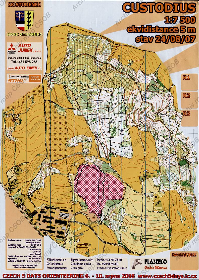
| Scale | 1:7500 | Equidistance | 5.0m | Sport | Foot-O | Specification | ISOM (foot-O) |
|---|---|---|---|---|---|---|---|
| Year | 2007 | Published by | SK Studenec | Filing number | 070626Z | ||
| Blocking until | 2016 | Blocking reason | |||||
| Map admin | PaeDr.Petr Junek, pejust@seznam.cz | Publisher | STH - SK Studenec | Educational map | ne | ||
| Locality | Studenec (Jilemnice 7jjv) | Area size | 3.32 km2 | ||||
| Based on | - | Stav | Drawing technique | OCAD 9 | |||
| Printed in | Reklamy Jilemnice | Print technique | CMYK | ||||
| Note (public) | dole uvedeno Czech 5 days orienteering, 6.-10.srpna 2008 | ||||||
| Entry created by | archiv ČSOS | Archive | aaa1 | ID/status | 4895 / archived | ||
Autoři
| Name | Role |
|---|---|
| Vik Martin | graphic designer |
| Hrubý Ladislav | mapped |
| Klouček Martin | mapped |
| Marek Jiří | mapped |
Obrys mapy
Map preview
Using the map without publisher's permission for organized events is copyright piracy. Please contact the map administrator listed in the Map Archive database and obtain maps in full quality for printing.
Našli jste problém v záznamu (nesprávné nebo chybějící údaje, špatný obrys)? Budeme rádi, pokud nám o tom řeknete.