Mapa byla schválena.
Basic map data
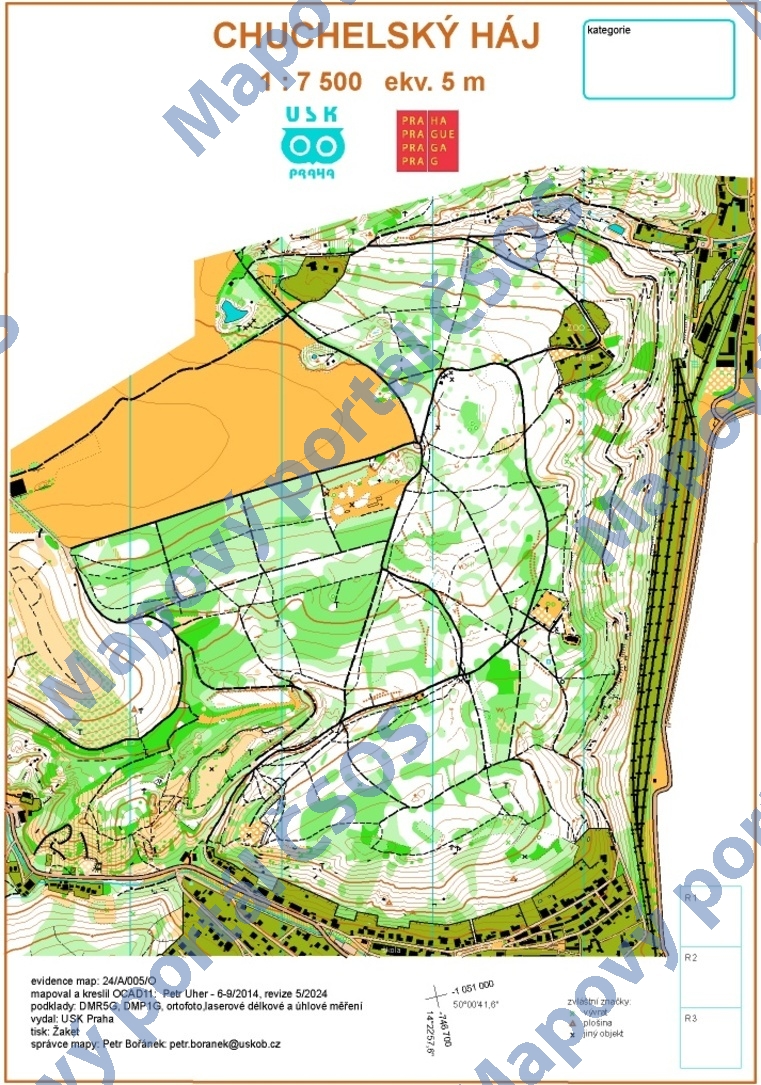
| Scale |
1:7500 |
Equidistance |
5.0m |
Sport |
Foot-O
|
Specification |
ISOM (foot-O)
|
| Year |
2024
|
Published by |
USK Praha |
Filing number |
24A005O |
| Blocking until |
2033 |
Blocking reason |
|
| Map admin |
Petr Bořánek
|
Publisher |
VSP - USK Praha
|
Educational map |
ne |
| Locality |
Malá Chuchle |
Kraj |
Praha |
Area size |
2.557 km2
|
| Based on |
DMR 5G |
Stav |
květen 2024 |
Drawing technique |
OCAD 11
|
| Printed in |
Žaket |
Print technique |
laser
|
| Main race (title) |
přebor škol
|
Main race (date) |
15. 05. 2024 |
| Entry created by |
Petr Uher |
|
ID/status |
13347 / approved and closed |
Autoři
Obrys mapy
Map preview
Using the map without publisher's permission for organized events is copyright piracy. Please contact the map administrator listed in the Map Archive database and obtain maps in full quality for printing.