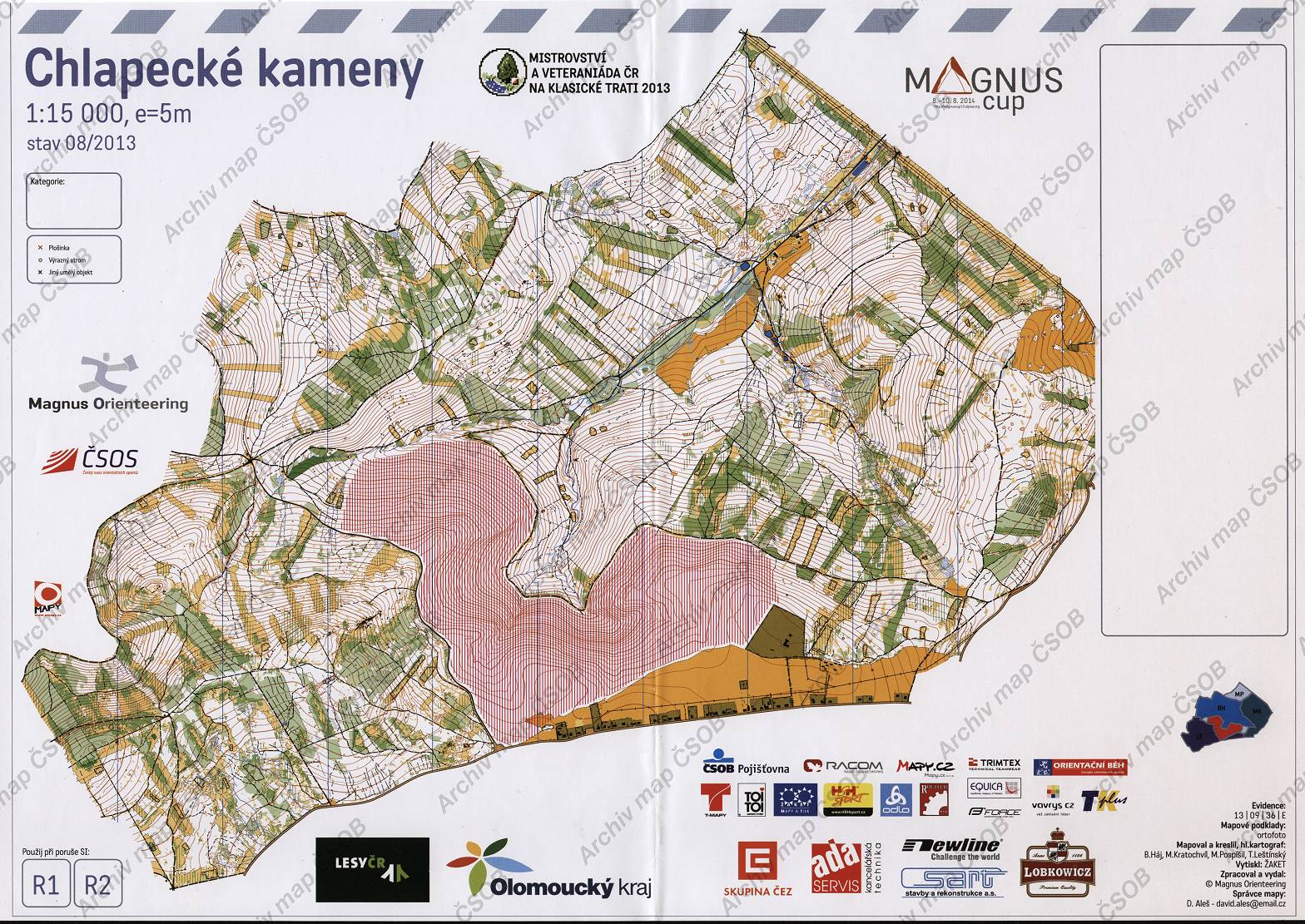
Map Chlapecké kameny
Basic map data
| Scale | 1:15000 | Equidistance | 5.0m | Sport | Foot-O | Specification | ISOM (foot-O) |
|---|---|---|---|---|---|---|---|
| Year | 2013 | Published by | Magnus Orienteering | Filing number | 130936E | ||
| Blocking until | 2022 | Blocking reason | |||||
| Map admin | D.Aleš, david.ales@email.cz | Publisher | ASU - Magnus Orienteering | Educational map | ne | ||
| Locality | Rejvíz (Jeseník 8v) | Kraj | Olomoucký kraj | Area size | 12.381 km2 | ||
| Based on | ortofoto | Stav | 2013-08 | Drawing technique | OCAD | ||
| Printed in | Žaket | Print technique | CMYK + 1 color | ||||
| Main race (title) | MČR + veteraniáda klasika | Main race (date) | 21. 09. 2013 | ||||
| Entry created by | archiv ČSOS | Archive | aaa0 | ID/status | 6908 / archived | ||
Autoři
| Name | Role |
|---|---|
| Háj Bohumil 1956 | drew, mapped |
| Leštínský Tomáš | drew, mapped |
| Kratochvíl Martin | drew, mapped |
| Pospíšil Miroslav | drew, mapped |
Obrys mapy
Map preview
Using the map without publisher's permission for organized events is copyright piracy. Please contact the map administrator listed in the Map Archive database and obtain maps in full quality for printing.
Našli jste problém v záznamu (nesprávné nebo chybějící údaje, špatný obrys)? Budeme rádi, pokud nám o tom řeknete.