Mapa byla schválena.
Basic map data
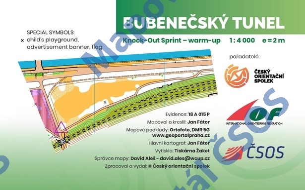
| Scale |
1:4000 |
Equidistance |
2.0m |
Sport |
Foot-O/print
|
Specification |
ISSprOM (sprint foot-O)
|
| Year |
2018
|
Published by |
Český orientační spolek |
Filing number |
18A015P |
| Blocking until |
2027 |
Blocking reason |
|
| Map admin |
David Aleš
|
Publisher |
TJN - OOB TJ Tatran Jablonec n. N.
|
Educational map |
ne |
| Locality |
Stromovka |
Kraj |
Praha |
Area size |
0.056 km2
|
| Based on |
ortofoto, DMR 5G, www.geoportalpraha.cz |
Stav |
2018-09 |
Drawing technique |
OCAD 11
|
| Printed in |
Žaket |
Print technique |
CMYK + 1 color
|
| Main race (title) |
Knock-Out Sprint warm up
|
Main race (date) |
04. 10. 2018 |
| Entry created by |
Jan Picek |
|
ID/status |
9945 / approved and closed |
Autoři
| Name |
Role |
| Fátor Jan |
mapped, drew, main cartographer |
Obrys mapy
Map preview
Using the map without publisher's permission for organized events is copyright piracy. Please contact the map administrator listed in the Map Archive database and obtain maps in full quality for printing.