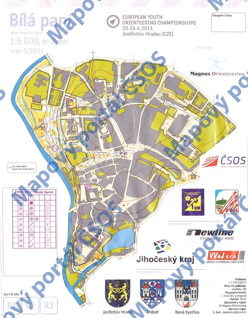
Map Bílá paní
Basic map data
| Scale | 1:5000 | Equidistance | 2.5m | Sport | Foot-O/print | Specification | ISSprOM (sprint foot-O) |
|---|---|---|---|---|---|---|---|
| Year | 2011 | Published by | Magnus Orienteering | Filing number | 110903E | ||
| Blocking until | 2020 | Blocking reason | |||||
| Map admin | D.Aleš | Publisher | ASU - Magnus Orienteering | Educational map | ne | ||
| Locality | Jindřichův Hradec | Kraj | Jihočeský kraj | Area size | 0.637 km2 | ||
| Based on | ortofoto, ZM10 | Stav | 2011-05 | Drawing technique | OCAD | ||
| Printed in | Žaket | Print technique | CMYK/laser | ||||
| Main race (title) | model pro sprint EYOC 2011 | Main race (date) | 23. 06. 2011 | ||||
| Entry created by | Pavel Dudík | Archive | b--0 | ID/status | 8196 / archived | ||
Autoři
| Name | Role |
|---|---|
| Fátor Jan | mapped, drew |
Obrys mapy
Map preview
Using the map without publisher's permission for organized events is copyright piracy. Please contact the map administrator listed in the Map Archive database and obtain maps in full quality for printing.
Našli jste problém v záznamu (nesprávné nebo chybějící údaje, špatný obrys)? Budeme rádi, pokud nám o tom řeknete.