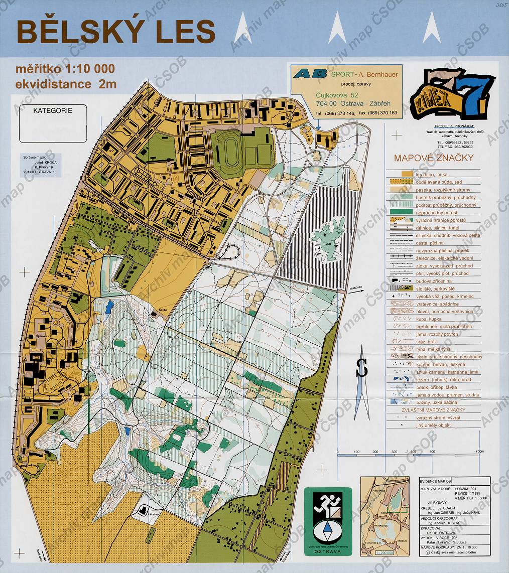
Map Bělský les
Basic map data
| Scale | 1:10000 | Equidistance | 2.0m | Sport | Foot-O | Specification | ISOM (foot-O) |
|---|---|---|---|---|---|---|---|
| Year | 1995 | Published by | SK OB Ostrava | Filing number | - | ||
| Blocking until | 0 | Blocking reason | |||||
| Map admin | Josef Kroča, P. Křičky 19, 701 00 Ostrava 1 | Publisher | MOV - SKOB Ostrava | Educational map | ne | ||
| Locality | Ostrava-Hrabůvka | Area size | 5.28 km2 | ||||
| Based on | ZM10 | Stav | Drawing technique | OCAD 4 | |||
| Printed in | KÚ Pardubice | Print technique | 5 colors | ||||
| Entry created by | archiv ČSOS | Archive | aab2 | ID/status | 3605 / archived | ||
Autoři
| Name | Role |
|---|---|
| Csibrei Jan | drew |
| Král Josef | drew |
| Ryšavý Jiří | mapped |
| Hostaš Jindřich | main cartographer |
Obrys mapy
Map preview
Using the map without publisher's permission for organized events is copyright piracy. Please contact the map administrator listed in the Map Archive database and obtain maps in full quality for printing.
Našli jste problém v záznamu (nesprávné nebo chybějící údaje, špatný obrys)? Budeme rádi, pokud nám o tom řeknete.