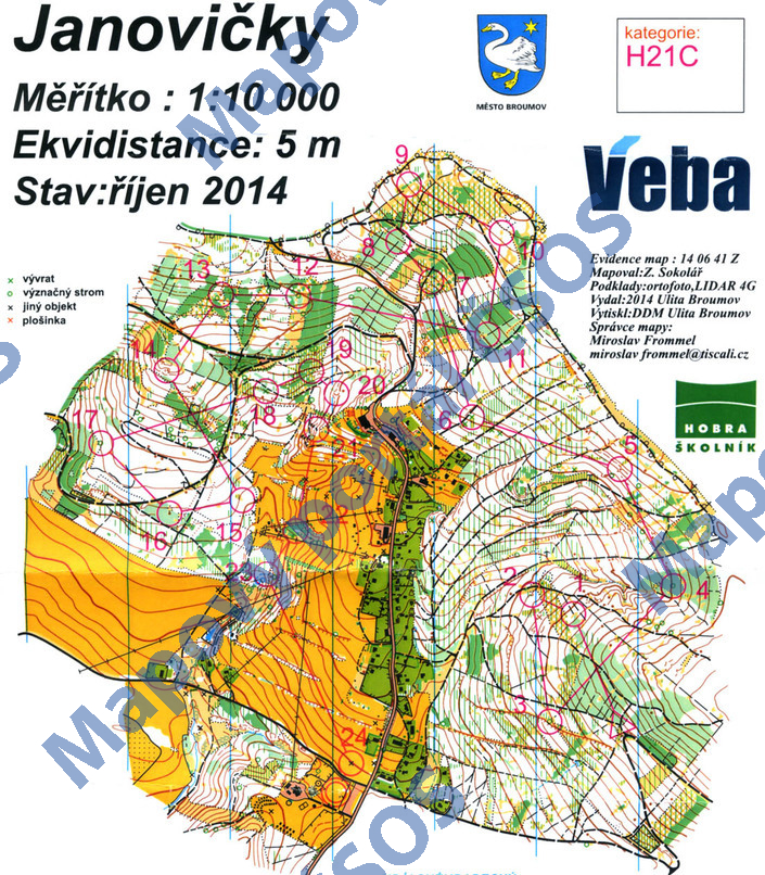
Map Janovičky
Basic map data
| Scale |
1:10000 |
Equidistance |
5.0m |
Sport |
Foot-O
|
Specification |
ISOM (foot-O)
|
| Year |
2014
|
Published by |
Ulita Broumov |
Filing number |
140641Z |
| Blocking until |
2023 |
Blocking reason |
|
| Map admin |
Miroslav Frommel
|
Publisher |
BRU - Ulita-HOBRA Orienteering Broumov
|
Educational map |
ne |
| Locality |
Janovičky, Broumov 5s |
Kraj |
Královéhradecký kraj |
Area size |
2.053 km2
|
| Based on |
ortofoto, LIDAR 4G |
Stav |
2014-10 |
Drawing technique |
OCAD
|
| Printed in |
DDM Ulita Broumov |
Print technique |
laser
|
| Note (public) |
Jen JPG. |
| Entry created by |
Pavel Dudík |
Archive |
c--0 |
ID/status |
8198 / archived |
Autoři
Obrys mapy
Náhled
Using the map without publisher's permission for organized events is copyright piracy. Please contact the map administrator listed in the Map Archive database and obtain maps in full quality for printing.