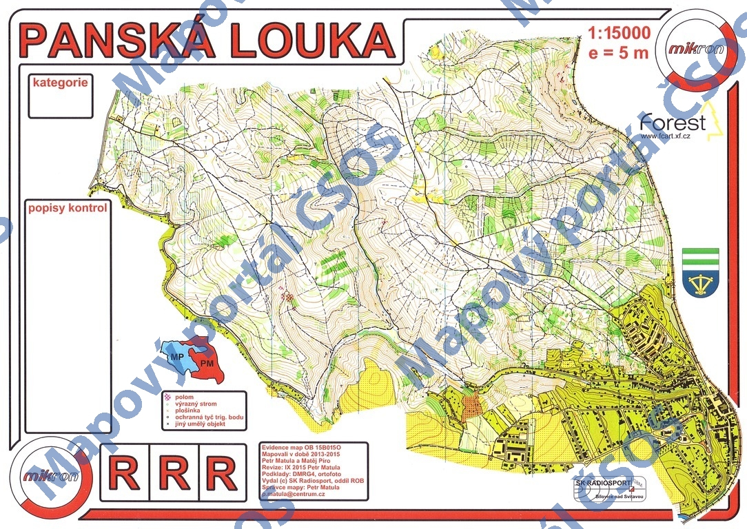
Map Panská Louka
Basic map data
| Scale |
1:15000 |
Equidistance |
5.0m |
Sport |
Foot-O
|
Specification |
ISOM (foot-O)
|
| Year |
2015
|
Published by |
SK Radiosport, oddíl ROB |
Filing number |
15B015O |
| Blocking until |
2024 |
Blocking reason |
|
| Map admin |
Petr Matula
|
Publisher |
MBM - O-mikron
|
Educational map |
ne |
| Locality |
Bílovice nad Svitavou |
Kraj |
Jihomoravský kraj |
Area size |
6.238 km2
|
| Based on |
DMRG4, ortofoto |
Stav |
2015-09 |
Drawing technique |
OCAD 10
|
| Printed in |
CCB |
Print technique |
laser
|
|
Main race (title)
|
Oblastní žebříček
|
Main race (date) |
2015-10-03 |
| Entry created by |
Jiří Zelinka |
Archive |
aaa0 |
ID/status |
8084 / archived |
Autoři
Obrys mapy
Náhled
Using the map without publisher's permission for organized events is copyright piracy. Please contact the map administrator listed in the Map Archive database and obtain maps in full quality for printing.