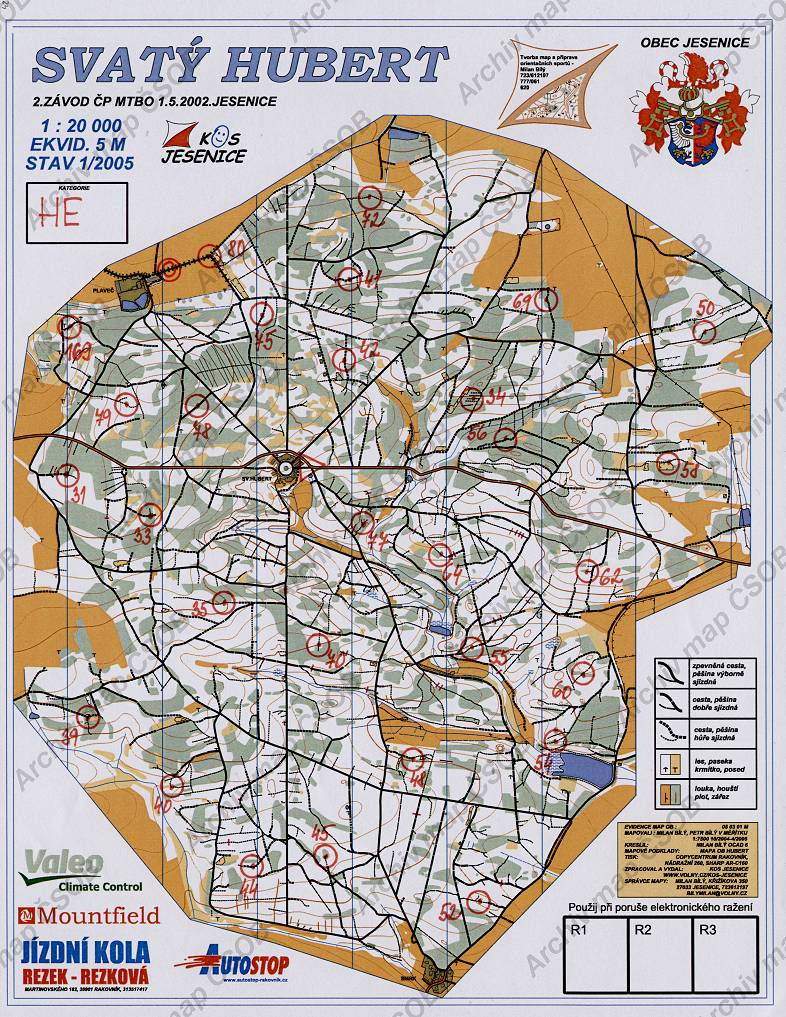
Map Svatý Hubert
Basic map data
| Scale |
1:20000 |
Equidistance |
5.0m |
Sport |
MTBO
|
Specification |
ISMTBOM (MTBO)
|
| Year |
2005
|
Published by |
KOS Jesenice |
Filing number |
050301M |
| Blocking until |
2014 |
Blocking reason |
|
| Map admin |
Milan Bílý, Křižíkova 350, 27033 Jesenice,bilymilan@volny.cz
|
Publisher |
JES - OK Rakovník
|
Educational map |
ne |
| Locality |
Svatý Hubert (Rakovník 16zjz) |
Kraj |
Středočeský kraj |
Area size |
13.469 km2
|
| Based on |
OB |
Stav |
2005-04 |
Drawing technique |
OCAD 6
|
| Printed in |
Copycentrum Rakovník |
Print technique |
laser
|
| Note (public) |
dat.závodu je na mapě chybně uvedeno 1.5.2002 |
| Main race (title) |
ČP MTBO
|
Main race (date) |
01. 05. 2005 |
| Entry created by |
archiv ČSOS |
Archive |
bbb0 |
ID/status |
4284 / archived |
Autoři
Obrys mapy
Náhled
Using the map without publisher's permission for organized events is copyright piracy. Please contact the map administrator listed in the Map Archive database and obtain maps in full quality for printing.