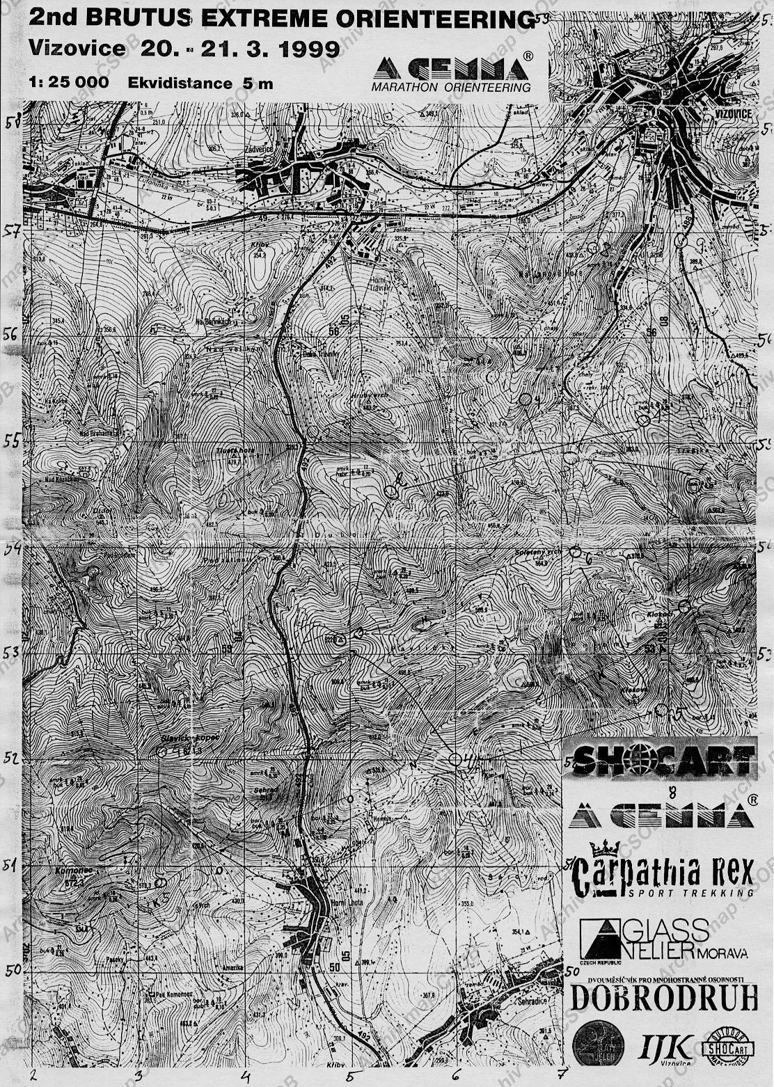
Map Vizovice
Basic map data
| Scale |
1:25000 |
Equidistance |
5.0m |
Sport |
Foot-O
|
Specification |
Topographic map
|
| Year |
1999
|
Published by |
SHOCART? |
Filing number |
- |
| Blocking until |
0 |
Blocking reason |
|
| Map admin |
-
|
Publisher |
VIZ - TJ Sokol Vizovice
|
Educational map |
ne |
| Locality |
Vizovice, Sehradice |
Kraj |
Zlínský kraj |
Area size |
59.253 km2
|
| Based on |
TM25 |
Stav |
- |
Drawing technique |
ink, pen
|
| Printed in |
- |
Print technique |
color copy
|
| Main race (title) |
Brutus Extreme Orienteering
|
Main race (date) |
20. 03. 1999 |
| Entry created by |
archiv ČSOS |
Archive |
x--0 |
ID/status |
3610 / archived |
Autoři
Obrys mapy
Náhled
Using the map without publisher's permission for organized events is copyright piracy. Please contact the map administrator listed in the Map Archive database and obtain maps in full quality for printing.