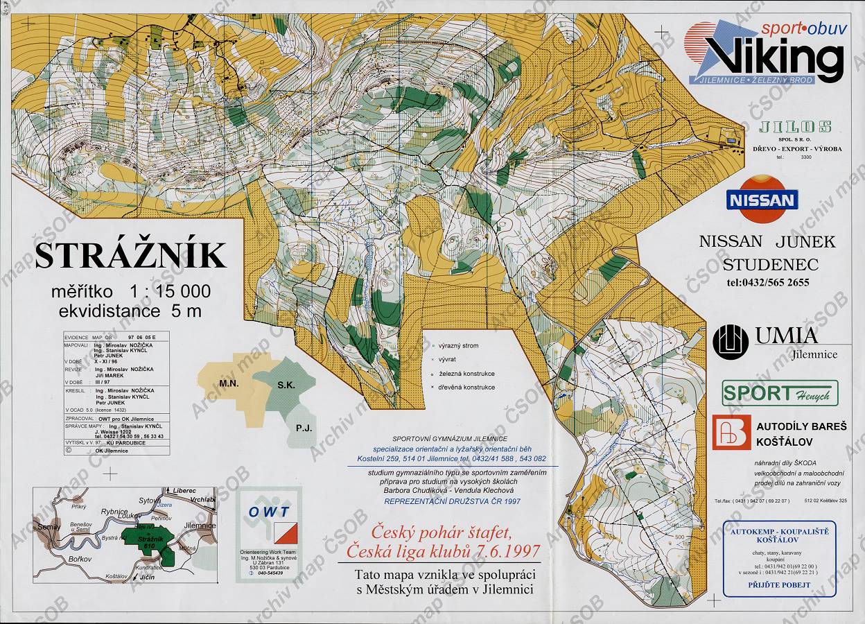
Map Strážník
Basic map data
| Scale |
1:15000 |
Equidistance |
5.0m |
Sport |
Foot-O
|
Specification |
ISOM (foot-O)
|
| Year |
1997
|
Published by |
OK Jilemnice |
Filing number |
970605E |
| Blocking until |
2006 |
Blocking reason |
|
| Map admin |
Ing.Stanislav Kynčl, J.Weisse 1202, 514 01, t. 0432-543059
|
Publisher |
JIL - OK Jilemnice
|
Educational map |
ne |
| Locality |
Háje nad Jizerou (Semily 6vsv) |
Kraj |
Liberecký kraj |
Area size |
7.069 km2
|
| Based on |
ZM10 |
Stav |
1997-03 |
Drawing technique |
OCAD 5
|
| Printed in |
KÚ Pardubice |
Print technique |
5 colors
|
| Main race (title) |
ČP štafet, Mříčná
|
Main race (date) |
07. 06. 1997 |
| Entry created by |
archiv ČSOS |
Archive |
aaa0 |
ID/status |
2437 / archived |
Autoři
Obrys mapy
Náhled
Using the map without publisher's permission for organized events is copyright piracy. Please contact the map administrator listed in the Map Archive database and obtain maps in full quality for printing.