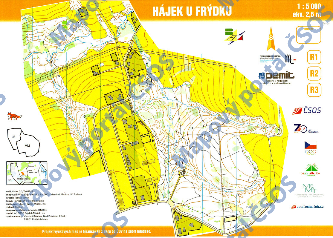
Map Hájek u Frýdku
Basic map data
| Scale |
1:5000 |
Equidistance |
2.5m |
Sport |
Foot-O/print
|
Specification |
ISSprOM (sprint foot-O)
|
| Year |
2020
|
Published by |
SKOB Frýdek-Místek |
Filing number |
20T015P |
| Blocking until |
2029 |
Blocking reason |
|
| Map admin |
Vlastimil Mutina, 725 686 762
|
Publisher |
BFM - SKOB Frýdek - Místek
|
Educational map |
ano |
| Locality |
Lískovec (Frýdek-Místek 2ssz) |
Kraj |
Moravskoslezský kraj |
Area size |
0.818 km2
|
| Based on |
ortofoto, DMR4G |
Stav |
2020-05 |
Drawing technique |
OCAD 10
|
| Printed in |
Kartum |
Print technique |
CMYK
|
| Note (public) |
OBJEV ŠOK. |
| Entry created by |
Vlastimil Mutina |
Archive |
aaa0 |
ID/status |
11091 / archived |
Autoři
Obrys mapy
Náhled
Using the map without publisher's permission for organized events is copyright piracy. Please contact the map administrator listed in the Map Archive database and obtain maps in full quality for printing.