Map Bílá skála
Map basic data
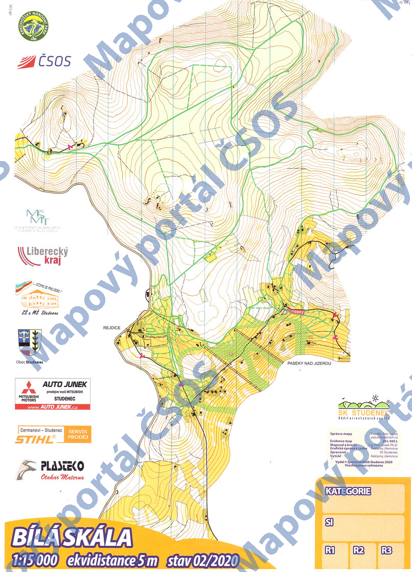
| Scale | 1:15000 | Equidistance | 5.0m | Sport | Ski-O | Specification | ISSkiOM (Ski-O) |
|---|---|---|---|---|---|---|---|
| Year | 2020 | Published by | Sportovní klub Studenec, z.s. | Filing number | 20L005L | ||
| Blocking until | 2029 | Blocking reason | |||||
| Map admin | PaedDr. Petr Junek | Publisher | STH - SK Studenec | Educational map | ne | ||
| Locality | Rejdice (Tanvald 4v) | Kraj | Liberecký kraj | Area size | 6.513 km2 | ||
| Based on | ortofoto, DMR4G | Stav | 2020-02 | Drawing technique | OCAD 10 | ||
| Printed in | Reklamy Jilemnice | Print technique | laser | ||||
| Main race (title) | Mistrovství ČR na klasické trati | Main race (date) | 2020-02-09 | ||||
| Entry created by | Petr Junek | Archive | aaa0 | ID/status | 10674 / archived | ||
Autoři
| Name | Role |
|---|---|
| Junek Petr 1978 | mapped, drew |
| Vik Martin | graphic designer |
Obrys mapy
Map preview
Using the map without publisher's permission for organized events is copyright piracy. Please contact the map administrator listed in the Map Archive database and obtain maps in full quality for printing.
Našli jste problém v záznamu (nesprávné nebo chybějící údaje, špatný obrys)? Budeme rádi, pokud nám o tom řeknete.